Land Registry title plans and planning location plans: the difference
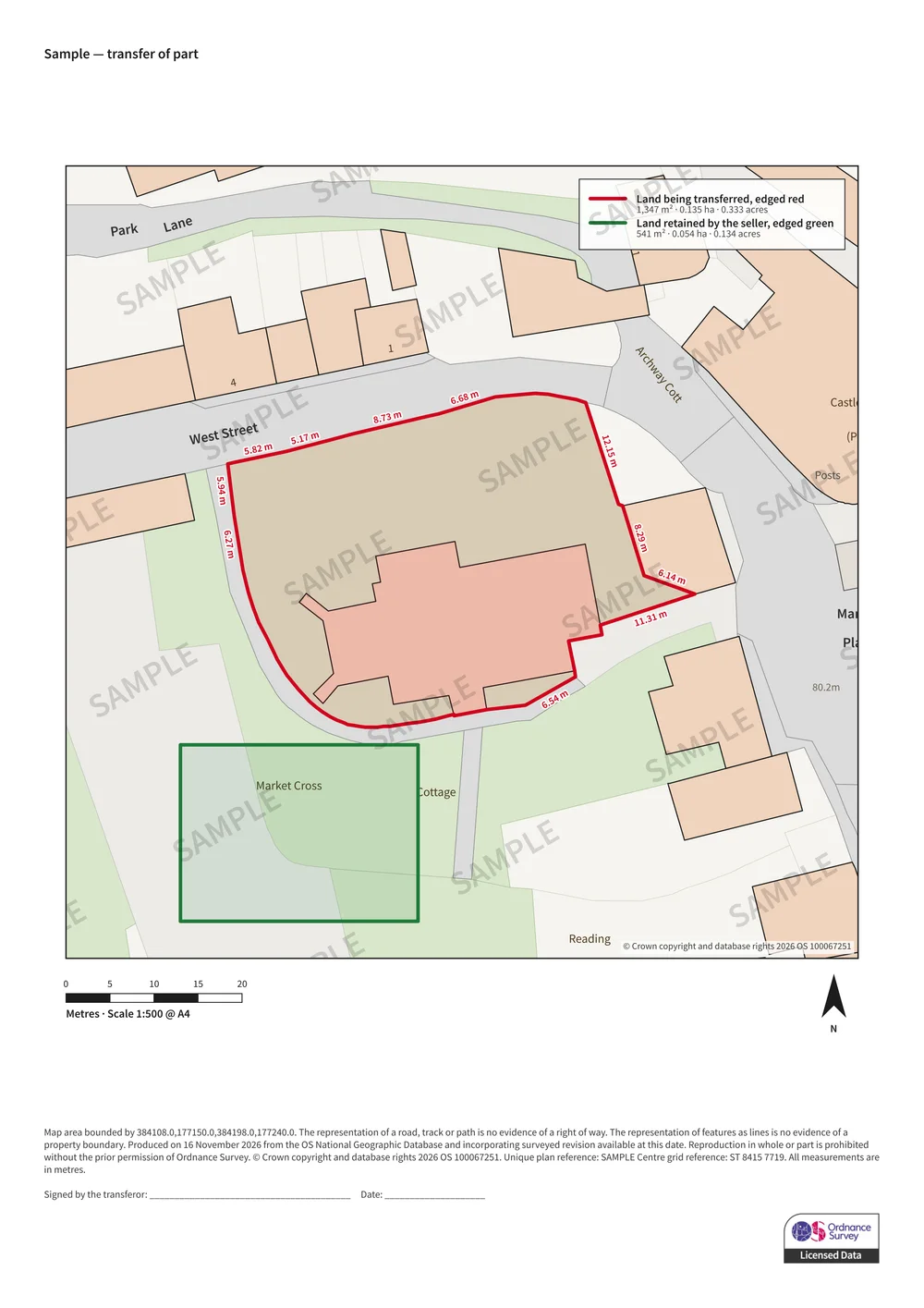
A title plan and a location plan look alike: both are Ordnance Survey maps with a red line on them. They answer different questions. A title plan shows the extent of what is registered to an owner. A location plan shows the extent of what a planning application is about. Confusing the two is a common cause of both rejected applications and neighbour disputes.
Last reviewed 12 November 2026. General guidance for England, Scotland and Wales — your council’s own requirements take precedence.
What a title plan shows
In England and Wales, HM Land Registry keeps a title plan for every registered property. It shows the extent of the registered land edged in red, drawn on Ordnance Survey mapping, normally at 1:1250 for urban land and 1:2500 for rural land.
The red edging is a general indication of where the land lies. Unless the register says the boundaries have been determined, a title plan does not show the exact position of a legal boundary. HM Land Registry says you should not rely on a measurement scaled from a title plan, and does not provide them.
You can download a copy for £7 from HM Land Registry’s property information service, or order an official copy by post on form OC1 for £11, at the prices it listed at the time of writing.
Scotland’s land register is kept by Registers of Scotland under its own legislation, with its own rules on how boundaries are shown. Check with Registers of Scotland for land there.
Why a title plan is not a planning location plan
Councils ask for a location plan drawn on current mapping at an identified scale, with a scale bar and north point, showing enough of the surroundings to find the site. A title plan is made for a different purpose and usually falls short:
- It is an extract made for the register, not a plan prepared for your application, and it may be years old.
- Its red edging shows registered ownership, which is often not the same area as your application site.
- Copies are frequently reduced or enlarged, which HM Land Registry warns distorts them, so the stated scale cannot be relied on.
Where title still matters to a planning application
Planning permission does not decide who owns land, and a red line on a location plan does not change your title. But ownership still affects the application, in two ways.
First, the ownership certificate on the application form depends on who owns the land inside your red line. If any of it belongs to someone else, such as a shared driveway or a strip beside the house, notice normally has to be served on that owner before you apply. A title plan is the quickest way to check who that is.
Second, a permission does not give you the right to build on land you do not own. If your red line, or the work itself, crosses onto a neighbour’s land, you still need their agreement, and for some work near a shared boundary the Party Wall etc. Act 1996 applies in England and Wales.
| Title plan | Planning location plan | |
|---|---|---|
| Made by | HM Land Registry | You or your agent, on licensed OS mapping |
| Red line shows | Registered ownership | The land the application covers |
| Scale | Usually 1:1250 or 1:2500, not for measuring | 1:1250 or 1:2500, stated, with a scale bar |
| Used for | Proving and checking ownership | Identifying the application site |
Common questions
Can I use my Land Registry title plan as a location plan?
Usually not. Councils want a plan prepared for the application at an identified scale, with a scale bar, a north point and the application site edged in red. A title plan shows registered ownership instead, often at an unreliable scale once copied, and may not match the application site.
Are Land Registry boundaries exact?
No. In England and Wales a title plan shows general boundaries unless the register records that they have been determined. It indicates where the land lies, not the exact line of the legal boundary, and should not be measured.
Should my red line match my title plan?
Not necessarily. The red line encloses the land the application relates to, which may be smaller than your title, or include land you do not own, such as an access route. Where it includes land you do not own, the ownership certificate and notice rules apply.
How do I get a copy of my title plan?
In England and Wales, download it from HM Land Registry’s property information service, or order an official copy on form OC1. In Scotland, apply to Registers of Scotland.
Need the plans themselves?
We draw location and block plans on current, licensed Ordnance Survey mapping at a true stated scale, with your red line boundary, north arrow, scale bar and our OS licence number. Draw the boundary yourself and see the price before you buy.
Create your plan