Land Registry compliant plans, drawn on current OS mapping
Selling off part of a garden, buying a strip from a neighbour or granting a lease of part needs a plan HM Land Registry will accept. Draw it yourself on Ordnance Survey MasterMap: the land edged red, what the seller keeps, any right of way, and the measurements.
Last reviewed 14 November 2026 against HM Land Registry practice guide 40, supplement 2.
Draw my Land Registry plan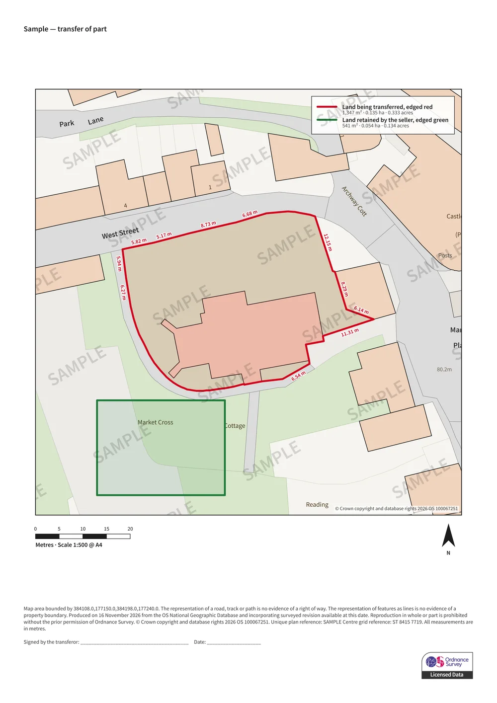
What Land Registry asks for, and how the plan meets it
Drawing a new boundary
Most transfers of part create a boundary that is not on the map yet. Start from your plot as it is mapped — tap your house and the editor draws it — then:
- Split it with a line across the land, and tap the part being sold. The rest becomes the land the seller keeps, edged green.
- Edit shape to drag corners. They snap to mapped walls, fences and building corners, because a new boundary usually follows one.
- Turn on measurements to label each edge in metres to two decimal places. They are measured from the map, so check them on site — for anything contentious, use a surveyor.
A title plan is not the same thing
The title plan Land Registry holds shows the general boundaries of a registered title. The plan you attach to a transfer of part defines the new piece. See title plans vs location plans for how they differ from the plans a council wants.
Questions
When do I need a plan for HM Land Registry?
When the land in a deed is not a whole registered title: selling or buying part of a garden or field, a strip of land between neighbours, a new lease of part of a building or land, or a new plot on a development. Selling a whole title needs no new plan, because the title plan already shows it.
What makes a plan Land Registry compliant?
HM Land Registry’s guidance asks for a plan drawn to a stated metric scale, with a north point, showing enough detail to locate the land on the Ordnance Survey map, with the land clearly edged or coloured and every colour explained. It should not be marked “for identification only” or “do not scale”. Measurements, where shown, should be in metres to two decimal places. The plan is signed by the transferor.
Can I use a planning location plan?
Not as it is. Planning plans normally carry a “do not scale” note, which Land Registry does not accept on a deed plan, and they have no signature line. Choose the Land Registry plan in our editor and the sheet is produced without that note and with the signature line.
What colours should I use?
Land Registry does not prescribe colours — it asks that each one is explained. Common practice is red edging for the land being transferred, green for land the seller keeps, and brown or blue for rights of way. You can edit the legend text so it matches the wording of your deed exactly.
Can you draw a plan for a flat or maisonette?
No. A flat or maisonette needs floor-level plans showing the internal layout of each floor, prepared by a surveyor or architect. A plan drawn on the Ordnance Survey map cannot show that, so we ask you to confirm the property is not a flat before ordering.
Does Land Registry accept OS-based plans drawn online?
Land Registry assesses the plan, not who drew it. Our plans are produced from current Ordnance Survey MasterMap data, to scale, with a scale bar and north point. Your conveyancer will check the plan against the deed before it is lodged.